High-tech conservation
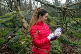
Katy Fulton uses an iPad regularly in her stewardship and monitoring work (Photo by Ben Fox)
Many people now use their iPad to communicate, be entertained, informed and conduct business in a highly mobile fashion. The development of software apps to support these activities has been prolific. This has included the development of several apps that support field-based geographic information systems (GIS) linked to global positioning systems (GPS) technology and supported by the latest high resolution satellite imagery or geo-referenced aerial photography.
In fact, these apps are so effective that in the Nature Conservancy of Canada's (NCC's) BC Region, all field-based inventory and mapping is now completed using the common iPad. One app in particular, GIS Pro (Garafa) has proven to be very effective in helping NCC staff accomplish a higher quality of work, much more quickly than before. When working in a Wi-Fi zone, staff can open the GIS Pro app, and see a digital atlas of the Earth much like what one sees in Google Earth. They can quickly and easily switch back and forth between satellite imagery, topographic terrain maps or other pre-configured base map displays.
Existing GIS data pertaining to a given property, such as a property boundary line, can easily be uploaded by emailing it to the iPad. Staff can then zoom into the property in question and very easily “cache” the background base maps they want into the iPads memory, so that when they head out into the field, they can still see the base imagery without needing to be connected to the internet.
Because the iPad models we chose come with a powerful GPS receiver, we can see exactly where we are on a property with the satellite image underneath us. We can then use the program to begin making points, lines and polygons to record the location and attribute data pertaining to any feature of interest.
For example, staff can walk a fence line and accurately map its position with the GPS tracking our every move. We can then add data to that line, such as what it is made of. The iPad's built-in camera can be used to add photos to the attribute data. If the fence crosses a wetland that we cannot walk across, we can simply pause the GPS recorder, walk around, and start it again. We can edit the points that make up the line quickly and easily in the field.
After recording all our field data, we can export the files to our GIS computers back in the office by simply emailing them. If we are in an area with cell reception, this can be done in the field. The iPad can have its own SIM card and function like a smart phone independently. Or using the-built in Bluetooth radio, the iPad can connect to the operator’s smart phone and rely on its capabilities to connect through the cellular system.
Of course staff can also upload all sorts of field guides and other tools via the amazing array of apps available. A popular choice is iBird (Mitch Waite Group). Beyond functioning like a bird book, iBird can also play several of the sounds a bird typically makes, making identification more reliable. In addition, there are tools such as Theodolite (Hunter Research and Technology LLC) that function like a compass and clinometer in one, using the iPad’s camera for visual input. This can tell us which direction we are facing, or measure angles up and down from the horizon.
There is no question that our productivity has increased dramatically since adopting this new technology. It has also vastly reduced the amount of time required to train new users, since it is so user-friendly. This is really important to our interns, who are with us for only a limited time each summer. An added bonus: compared to the tools we used previously to do the same thing, this new iPad-based system can be obtained for about 10 per cent of the price — an incredible savings that helps us to make our supporters' money go even farther than ever before.
I'd say that's pretty high-tech conservation!
