Science is for the birds
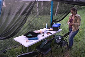
MAPS station at Big Valley property, SK (Photo by NCC)
As a summer intern for the Nature Conservancy of Canada (NCC), I have had the opportunity to participate in many cool conservation activities. One of the neatest projects I got to work on this past summer was the MAPS station that NCC is running on our Big Valley property in Saskatchewan. MAPS stands for monitoring avian productivity and survivorship, and it involves banding birds with special leg bracelets so that they can be more easily studied.
How does it work?
MAPS stations are set up in one location and then revisited numerous times over the summer breeding season. The longer a MAPS station runs, the more data it can collect, so most MAPS stations continue to operate year after year.
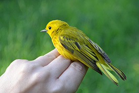
Trained NCC staff handling a yellow warbler at the Big Valley property MAPS station (Photo by NCC)
At the station, a series of fine mesh nets are set up to catch birds. The birds are taken out of the nets by NCC staff trained to not harm the bird. Staff then collect information on the bird’s age, sex, reproductive status and body condition. The bird is then fitted with a lightweight aluminum leg band that has a unique code imprinted onto it. The bird is then safely released back into the wild.
Why capture birds?
If a bird is caught again, either by the same MAPS station or a different one, researchers can identify it because of the coded band. As birds are recaptured at different (or even the same) MAPS stations, it can provide researchers with all types of data.
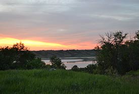
Big Valley property, SK (Photo by NCC)
Some of the questions that MAPS helps answer include what factors drive avian population declines, what is the relationship between population change, climate change and habitat loss and what can we do to reverse declines? These are big questions that require up–to-date data from all over North America.
The MAPS station also lets NCC know more about what is happening at the local level on our Big Valley property. It is important to know what species are on the property so that NCC staff can make informed decisions on how to manage and conserve the area.
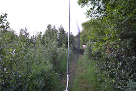
Doing a net run on NCC's Big Valley property, SK (Photo by NCC)
As an intern without a science background, it was very cool to help with such a meaningful science project. Doing net runs to see if any birds were in the nets was such a unique experience. Even just writing down the attributes of each bird was such a rush because I got to watch as NCC's bird experts determined the bird’s age and sex. I was especially lucky to be involved in this project because there are only four active MAPS stations in Saskatchewan, and the Big Valley MAPS station is the only one that NCC runs.
I am so happy that I got to help with such important scientific research while interning at NCC. Experiences like MAPS make the intern program at NCC so special.
The Conservation Internship Program is funded in part by the Government of Canada’s Summer Work Experience program.
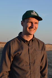
About the Author
Logan Salm was a 2018 summer communications intern for the Nature Conservancy of Canada in Saskatchewan.
