Siri, where's the nearest conservation area? Celebrate GIS Day with NCC
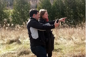
Gary White and Laura Robson in the field, ON (Photo by NCC)
Have you ever used Google Maps or Siri to find directions to the closest coffee shop?
Congratulations!
You just conducted a GIS analysis and are encouraged to celebrate GIS Day on November 20.
GIS Day started in 1999 and is held on the third Wednesday of every November. It is a day for geographic information systems users and vendors to open their doors to the public and demonstrate real-world applications of GIS. These demonstrations also engage people to learn and, in some cases, contribute to mapping projects.
How far we've come
Traditionally GIS software was reserved for government and education institutes that could invest in the hardware needed to run these types of programs. The early to mid-80s saw many vendors begin to develop commercially available GIS, but the first Windows-based desktop GIS wasn’t seen until 1990, when GIS capabilities began to move from the research environment into the business world.
Since then, the availability of geospatial software (commercial and open-source) and data have advanced so rapidly that you may be a GIS user without even being aware of it.
GIS in your back pocket
Nowadays, web-based GIS applications can be found on almost every mobile device, such as smart phones or tablets that have internet access or built-in GPS receivers. The ready access to this type of technology has also spurred governments and non-profit organization to encourage people to become "citizen mappers." By providing volunteers with standardized data collection methods and web-based mapping platforms to submit geospatial information, members of the public can greatly contribute to topographic mapping efforts or environmental monitoring.
This allows everyday citizens to make significant contributions to these groups' abilities to provide or analyze accurate information.
GIS at NCC
The Nature Conservancy of Canada has used GIS applications to help in land acquisitions and property management for the last 10 years. Staff use GIS to develop landscape-level models that help determine areas of high conservation value. This helps to prioritize where we will focus our efforts.
Once land is secured, GIS continues to play an important part in the land management of the property. Field staff are continually collecting spatial information on the properties, such as endangered species or threats to biodiversity. They use GIS to build an inventory that will help to develop management strategies and measure effectiveness of those plans.
Celebrating a tool that connects us all
While GIS Day will never become a national holiday, it is still a wonderful opportunity to recognize how different organizations and even individuals around the world use this resource in innovative ways to bring about awareness of important issues both globally and locally.
"Siri…Have you found that coffee shop yet?"

About the Author
Gary White is the former GIS and conservation data coordinator for NCC in the Ontario Region.
