GIS in conservation 101
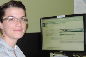
Maude Benny, former GIS & conservation data analyst (Photo by NCC)
What is GIS?
Geographic Information Systems (GIS) is a computer-based tool for gathering, managing, and analyzing data.
How is GIS used in conservation?
A common way of putting data together using GIS is to use its “where” information to create a map that illustrates how all of the information relates to each other:
- Where are the lakes, rivers and wetlands?
- Where have endangered species been seen?
- Where are the different ecosystems that make up the landscape?
Geographic Information Systems can also be used to answer complex questions about this mapped information that would otherwise be difficult to answer:
- What areas have the highest diversity of species?
- Where is the most suitable habitat for a particular species?
- What areas are in the best condition, but are under the greatest threat?
The answers to these and other questions help conservation planners determine what lands should be targeted as conservation priorities.
How does NCC use GIS?
Huge amounts of data need to be pulled together and distilled into understandable information that can be used by the Nature Conservancy of Canada's (NCC's) conservation planners.
The power and flexibility of GIS to combine and analyze large volumes of data makes it a critical technology in all aspects of NCC’s work.
A wide variety of information from numerous sources goes into the decisions that NCC makes about where to work, and what needs to be done to protect and enhance the biodiversity present in the landscape. It is the “where” information of GIS that allows NCC assemble and analyze large amounts of information about the places it works.
How is GIS used to manage NCC properties?
Once NCC identifies the properties and natural areas where it wants to prioritize its efforts, GIS continues to be a useful conservation tool in the management of properties under NCC’s care.
Stewardship staff use GIS to inventory features of properties such as:
- the locations and condition of species;
- the position of roads, buildings, fences and other infrastructure;
- any potential problems or threats that need to be addressed, such as patches of invasive species.
Using GIS to keep track of all of these features (and where they are on a property) allows NCC to understand the impact of its management activities, and constantly improve its practices.
With the help of GIS, NCC continues to be a leader in conservation by identifying areas that most urgently need conservation and the management of the properties we’ve secured.