Atlas of natural habitats of conservation interest in the Southern Laurentian Natural Province
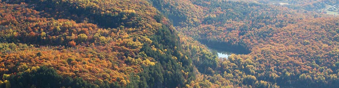
Kenauk, QC (Photo by Mike Dembeck)
Context
Faced with the dual crisis of climate change and biodiversity loss, it is essential to have precise decision-making tools in developing effective conservation strategies. In Quebec, atlases of areas of conservation interest have been developed for the St. Lawrence Lowlands, and Gulf and Estuary of St. Lawrence ecoregions by the Ministère de l’Environnement, de la Lutte contre les changements climatiques, de la Faune et des Parcs (MELCCFP) and Environment and Climate Change Canada (ECCC). The Nature Conservancy of Canada (NCC), in partnership with MELCCFP and Environment and Climate Change Canada, has developed an atlas dedicated to the Southern Laurentian region of the province.
The Southern Laurentians is a vast area north of the St. Lawrence River, in the southwestern part of the Canadian Shield. Stretching from the Ottawa River to the Charlevoix region, it is home to a large diversity of species and ecosystems that face a number of pressures from human activity.
Despite the region’s high conservation potential, until now there has been no large-scale planning tool that integrates all of the area’s natural habitats and key elements associated with its biodiversity. The atlas fills this gap by presenting the sites with the greatest conservation needs. The aim of the tool is to support the development of conservation strategies (protection, restoration and sustainable use) by the various partners in the area.
Interactive map (French only)
To view the map in full screen, click here.
Using the map
The interactive map’s basic display shows where mosaics of high-quality ecosystems are concentrated, by superimposing 2, 3 or 4 types of natural habitat, also known as conservation targets. This display makes it easier to identify natural habitats of diverse interest.
Click on the layers icon in the toolbar on the left of the map to view the atlas’s data according to these six conservation targets (coarse filter):
- forest environments
- wetlands
- lotic aquatic environments (waterways)
- lentic aquatic environments (water bodies)
- open areas (wildland)
- open environments (agricultural grassland)
Users can view either one or several targets simultaneously. They can also choose a personalized conservation objective (representativeness threshold) for each target.
The map’s basic display corresponds to a conservation threshold of 30 per cent. This means that only the 30 percent of the natural habitats of greatest conservation interest are displayed. This threshold is based on the objectives of the Kunming-Montreal Global Biodiversity Framework, which aims to have 30 per cent of land and oceans protected by 2030. It is important to note that this threshold is only a suggestion and that NCC encourages users to aim for a more ambitious target of 40 per cent or 50 per cent.
Methodology
The sites of conservation interest for each of the natural habitats were determined on the basis of selection and prioritization analyses, using a series of criteria validated by an expert committee. Find out more about the methodology used here: Methodological report (french only).
This document also describes the ecological context, the main pressures on the natural habitat and the conservation context in which the atlas is being developed.
Support
The interactive map and the database displayed here are flexible tools that can meet the needs of multiple stakeholders in the field of conservation and land use planning. Using these tools can present certain challenges, however. That’s why NCC offers support that addresses:
- analyses and criteria used;
- databases and their attribute tables;
- interactive map functions; and
- potential uses for the atlas.
For support, please contact Pascal Côté, NCC’s project manager, science and conservation planning, at pascal.cote@natureconservancy.ca.
Major partner of the atlas
NCC would like to thank the Quebec government for its financial support in the creation of this Atlas of natural habitats of conservation interest in the Southern Laurentian Natural Province, through The Partenariat pour les milieux naturels project, which received financial assistance totalling more than $53 million.
About us
The Partenariat pour les milieux naturels project (PMNP) is a grant of more than $53 million over four years awarded by the Quebec government to the Nature Conservancy of Canada. Through the establishment of financial partnerships with the Province’s conservation organizations, it provides support for voluntary conservation initiatives aimed at ensuring the protection of natural habitats of interest. This way, PMNP aims to develop and consolidate Quebec’s network of protected areas located on private land.
Resources
Access the atlas database here: https://www.arcgis.com/home/item.html?id=761cf6d54e3e4400b69691a10d94d946 (french only)
The appropriate quote for this book is:
Côté, P., M.-È. Le Ber, J. Beaulieu, K. Monticone, K. Marineau, K.L. Higgins and M. Favreau. 2024. Atlas of natural habitats of conservation interest in the Southern Laurentian Natural Province, Nature Conservancy of Canada, 124 p.