Baseline inventories 101
Andrea Mosher, Port Joli, NS (Photo by NCC)
What is a baseline inventory?
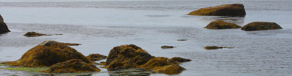
Shortly after the Nature Conservancy of Canada (NCC) acquires a new property, staff need to complete a baseline inventory. This gives NCC a snapshot of the land, species and ecosystems present upon it at the time of purchase.
The inventory records the significant flora, fauna and other notable elements on the property such as human activity or natural disturbances that may pose a threat to the plants, animals and habitat identified. The information gathered in the inventory will be used to create a property management plan, which will lay out the land management activities needed to care for the property.
How do staff prepare for the baseline inventory?
A few days prior to travelling to a property, NCC staff ensure they are prepared for their day in the field. This includes:
• organizing transportation and a travel plan;
• reviewing a map of the area and a summary of the property;
• contacting any relevant partners or landowners in the area to advise them of the visit;
• planning and packing appropriate tools such as a GPS unit, map and compass, first aid kit, bug repellent, rubber boots, etc.;
• creating a detailed safety plan.
How do staff pick a site to do a sample plot?
Often staff are already aware of variations in the vegetation, and have identified these in their GPS before arriving. However, this is not always accurate. Therefore, NCC staff sample areas and record sightings every time the vegetation or habitat type changes. They also take notes of any transitional area — where one type of habitat changes to another (for instance, from forest to riverbank).
What happens next?
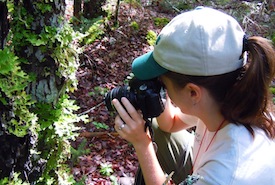
Usually, one team member records information while the other takes pictures and a GPS bearing. At the point of the GPS bearing, pictures are taken facing north, south, east and west as a visual record of the land. Staff will record the different types of vegetation, including trees, shrubs, herbs, mosses and grass. Any animals seen or heard on the site, as well as evidence of animals — such as tracks, droppings, shelters, scrapings etc. — are also noted. Staff also record any recent disturbances to the area, such as flooding, forest fire or human related activity (i.e. buildings or structures).
How often is this repeated?
Staff will continue to perform inventories each time vegetation changes on the land.