Trevor Reid-Nature Conservancy of Canada, Manager of Conservation Planning and Spatial Analysis
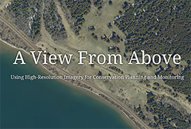
A view from above
Using high-resolution imagery for conservation planning and monitoring
What is the problem you are looking to solve or the question you are looking to answer?
The Nature Conservancy of Canada’s (NCC’s) Alberta Region is responsible for the management of over 200 conservation projects.
This presents a land management challenge when operating with limited stewardship resources across vast geographies. We are looking at innovative uses of technology to assist with this land management.
Can you give us a general description of the project?
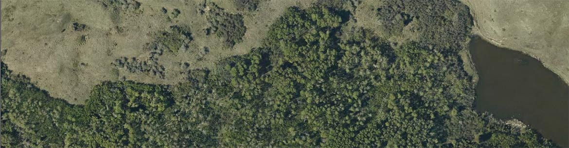
We began using aerial monitoring as a tool in 2014 and found great success in tackling large volumes of field work remotely. In 2019, we took the next step in our aerial monitoring program by obtaining high-resolution *orthorectified images of all of our conservation lands.
What will you learn from your project?
As this program continues, we hope to learn new ways in which we can use the imagery, both internally at NCC and with help from partner organizations.
What is the biggest achievement of the project to date?
The aerial monitoring program, in general, has helped NCC’s Alberta Region in two significant ways: by allowing staff to conduct a monitoring session remotely by means of detailed image interpretation; and by directing staff attention to issues or features that would be otherwise undetectable or potentially overlooked on the ground.
The 2019 *orthorectified imagery has helped, and continues to help, in creating accurate digital datasets of our lands. Due to the uniform scale and spatial correctness of the imagery, we can also calculate accurate geometries of these digitized datasets.
How can this project benefit NCC’s work and other conservation initiatives?
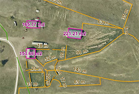
Measuring using aerial imagery (Photo by NCC)
Conducting desktop monitoring sessions using aerial images and having the ability to digitize high-resolution datasets of our lands without needing to be on the ground, allows staff to spend more time focusing on the many critical stewardship activities that cannot be conducted remotely.
What is your favourite part of the project you are working on?
The orthorectified images now serve as a basemap in our GIS software. As a GIS professional, this means working with higher resolution base imagery on all of our mapping projects.
What is the impact you are hoping to achieve in Alberta (or beyond) with the project you are involved with?
I think this is one example of how we can change the way we think about the management of our lands. It is an example of how we can use advanced technologies to assist our work.
Is there a place where people who are interested in your project can go to learn more?
Learn more about this project here.