Development needs can conflict with nature, but with knowledge we can grow together
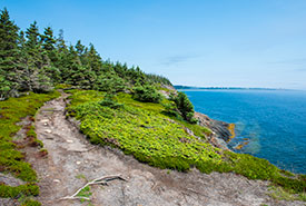
Gaff Point, NS (Photo by Andrew Herygers/NCC staff)
Our lives depend on nature. From the water we drink, to the air we breathe and the experiences we enjoy outdoors, nature makes it possible. But what happens to these nature-based services as the world’s resource needs evolve and climate change quickens?
In January, colleagues and I published research in Nature Communications that showed nearly one-third of the world’s priority areas for biodiversity conservation (about the size of North America) also intersect with industry and human development interests. That means that there will be potential conflicts between conservation, climate and development goals.
When you’ve got your feet on the ground, watching streams flow, flowers grow and animals move, up close, it's tough to grasp the scale of this challenge. But zoom out, and it comes into focus.
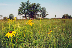
Prairie grassland, Manitoba (Photo by NCC)
Satellite views, long-term studies and local and Indigenous Knowledge have shown we’re losing or drastically altering nature at an alarming rate — over 80 per cent of native Prairie grasslands across Alberta, Saskatchewan and Manitoba have been lost, as have over 70 per cent of southern Canada’s wetlands, for example — we’ve had significant impacts on the nature around us. So, how do we rebalance our relationships with the land? How do we conserve species, lands and waters, while ensuring people have the space, food and resources they need? We’re now at a point where technology is revealing new ways of understanding our world.
The Nature Conservancy of Canada (NCC) and researchers at Carleton University have built a digital land-use planning tool that accounts for species’ ranges, biodiversity benefits, carbon storage and many other layers that can now suggest to us how to get the best bang for our conservation buck.
Interested in conserving habitat for a species like the endangered spotted turtle? New data mapping technology can help you focus your efforts, by highlighting the species’ habitat range for you at the click of a button. It goes further, too. On top of the spotted turtle’s range, our tool allows you to layer in elements such as other at-risk species’ ranges, carbon sinks, drinking water sources and human development maps. Seeing where all these elements might overlap, we can then give the tool a budget and ask it: how can we most effectively deploy our conservation resources?
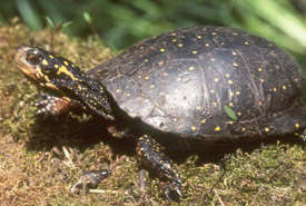
Spotted turtle (Photo by John Mitchell, Figment Films)
Thanks to the quality of the data and the power of this technology, land-use models that once took teams of conservation planners many hours or even days to assemble can now be churned out in less time than it takes to brew a pot of coffee.
Of course, we must go further, too, because when you’re doing land conservation, you need to understand that no species or natural process exists independently. Nature might be seen from satellites and maps, but it’s experienced on the ground. By listening to Indigenous Knowledge, recognizing people’s deep roots on the land, and involving communities in conservation decisions, we quickly see how everything connects.
It’s by using tools like ours in tandem with local and Indigenous Knowledge that we can efficiently find areas that, when conserved, offer compounding benefits to nature and people. We can model and better understand different scenarios and the future impacts of activities like nature restoration work and wetland conversion, new developments and species recovery, all through the lens of a changing climate. This way, communities can make informed and transparent choices about their relationships with the lands and waters around them.
As nature and communities are facing the ever-accelerating threats of biodiversity loss and climate change, the more efficiently we can restore, conserve and sustainably manage ecosystems, the better we can contribute to nature and community resilience.
Threading the needle on development requirements and nature’s needs
Local and Indigenous Knowledge teach us not just that humans can coexist with nature, but that we must. Our new modelling tools show that, too. For instance, colleagues and I recently used land-use planning technologies to show how protecting native pollinator habitat near farmland in Canada can actually increase yields, resulting in net benefits for people and nature, bolstering regional food security, supporting native species and creating economic opportunities. That’s just the beginning.
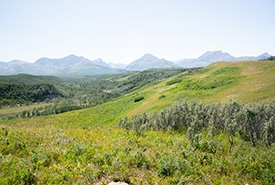
Yarrow Creek, Alb. (Photo Sean Feagan/CNC)
But while it’s great to know what to do in theory, it’s another thing altogether to implement it on the ground. We need decision-making partners across Canada to adopt these tools when doing land-use planning so that we can conserve the right places for species, nature and communities. By collaborating with local and Indigenous communities, we can seek to identify how these tools can support our shared objectives. In doing so, they can make tough decisions transparent, accountable, accessible and highly informed by multiple ways of knowing.
About the Author
Richard Schuster is the director of spatial planning and Innovation at the Nature Conservancy of Canada.
